Palm Jumeirah

COMPLETED BY BIMFLO

Villa - Palm Jumeirah Island

ADDRESS: – VILLA, DUBAI, UAE

Scope of Work: – We Carried out a 3D Laser Scan of the Villa in Palm Jumeirah to Deliver 3D BIM Model with the Required Level of detail.

Timeframe: – 1 day on-site, 4 days for 3D Revit BIM Model.

Need help?

Call us for more information or business inquiry.

+353 46 9072956

Case Study
VILLA ON PALM JUMERIAH ISLAND

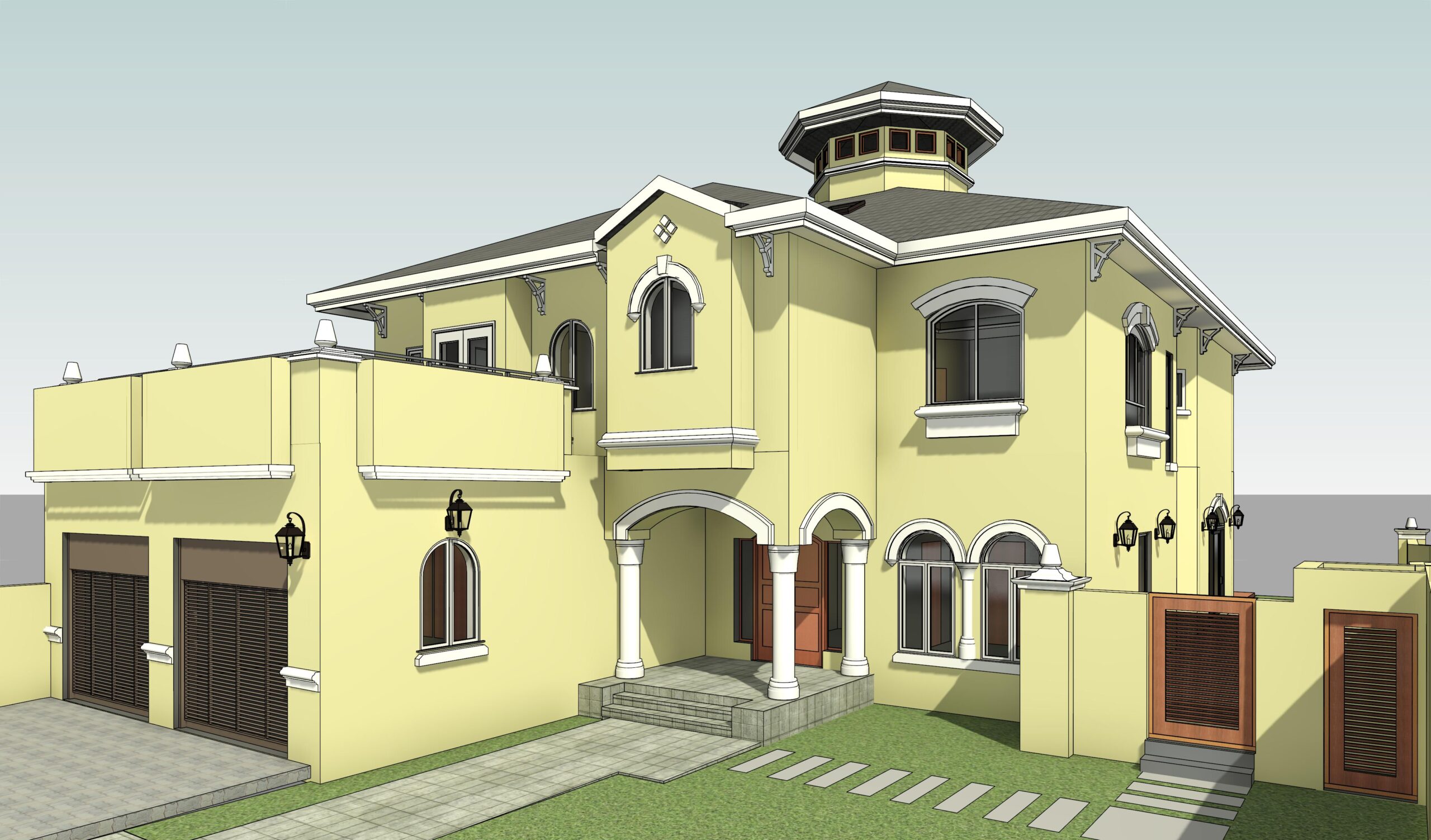
Palm Jumeirah is Dubai’s most captivating offshore destination, billed as the Eighth Wonder of the World. This amazing man-made island offers a luxurious beachfront lifestyle with a collection of magnificent resorts and some of the most exclusive residential properties right by the Arabian Sea.

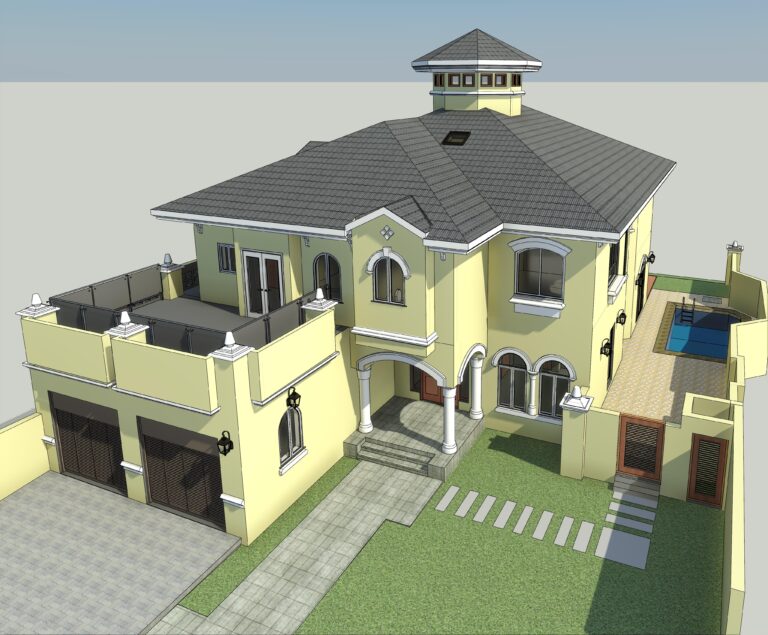
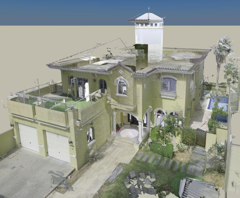
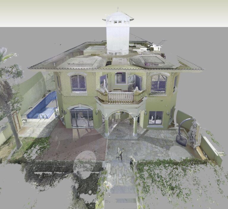
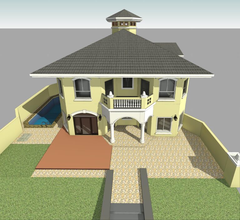
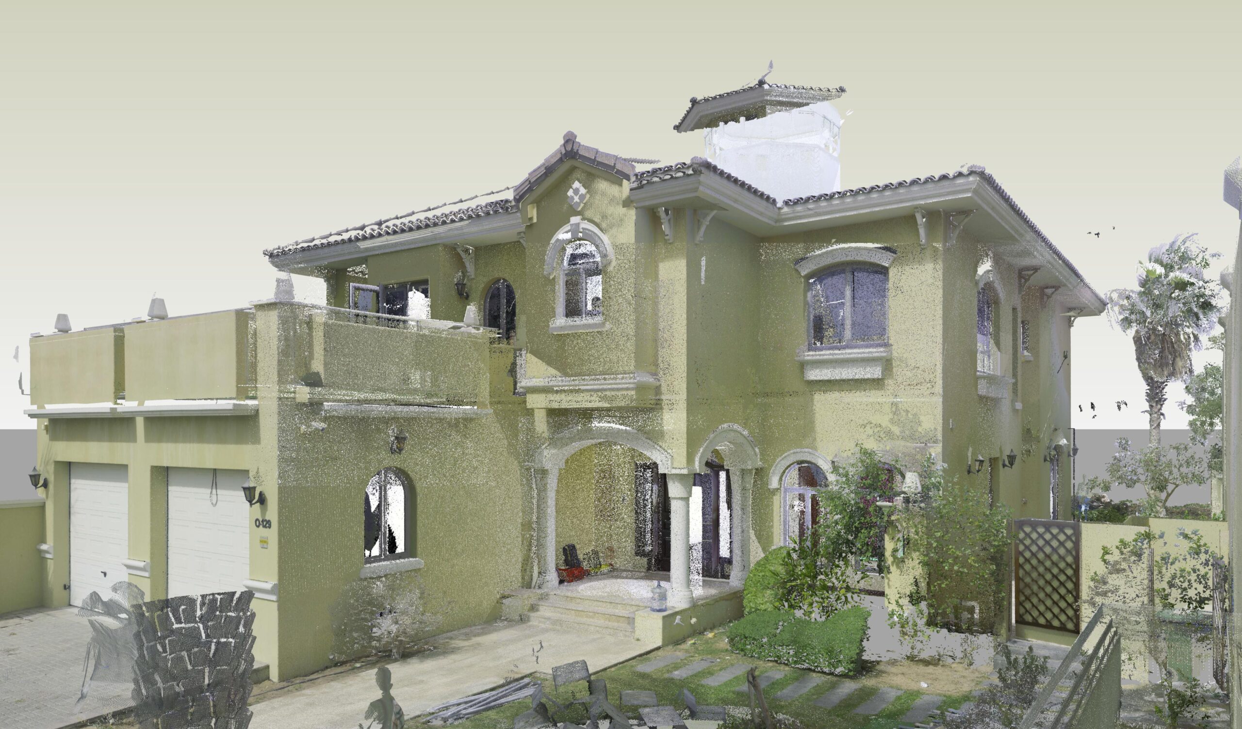
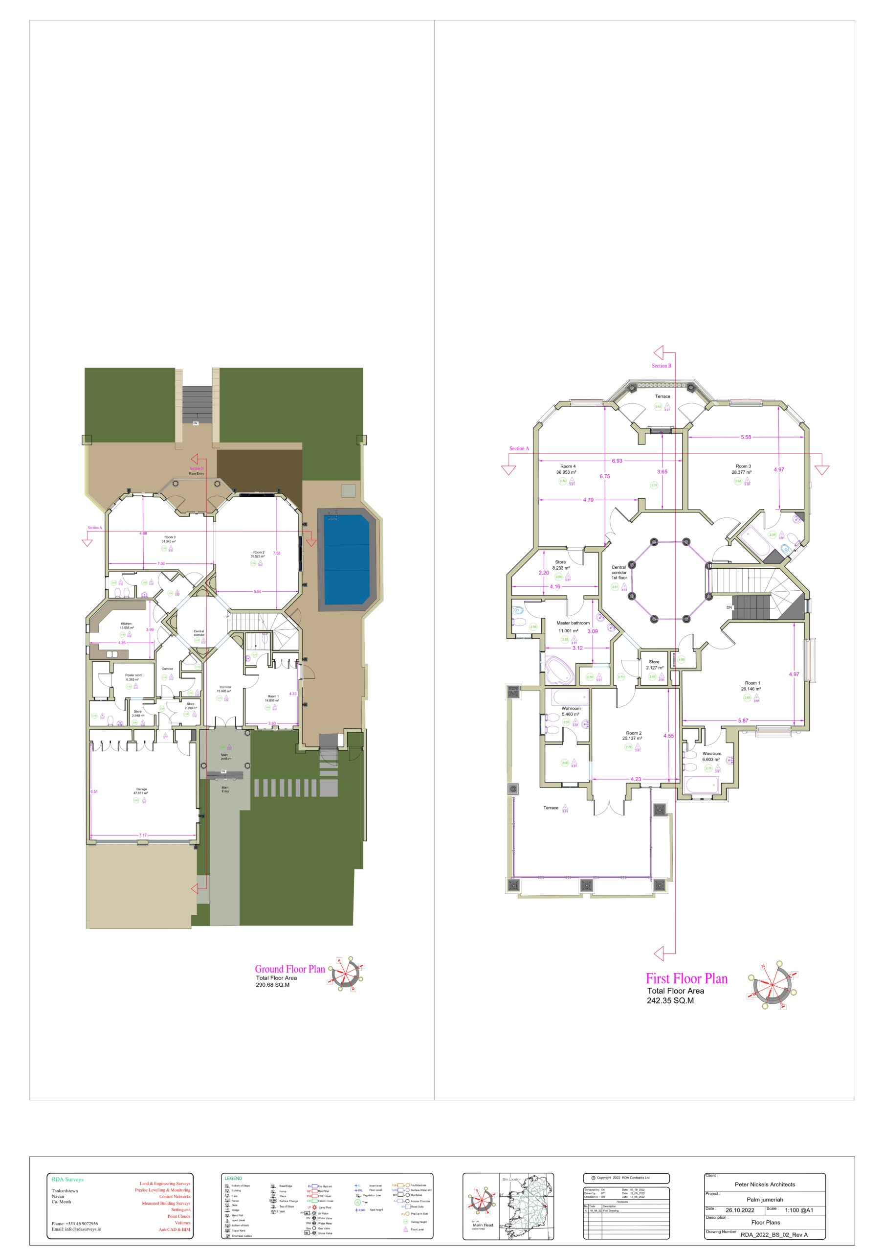
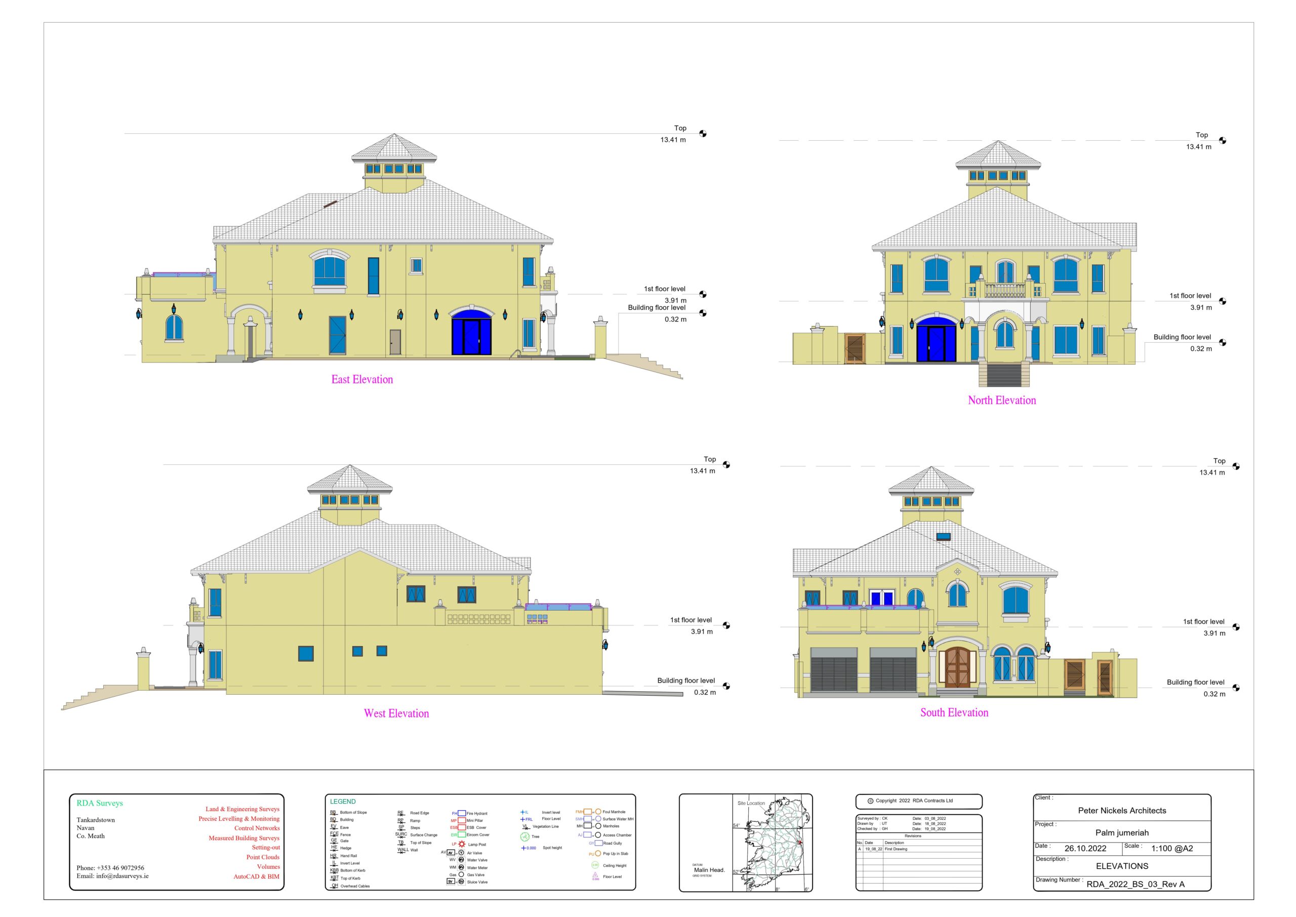
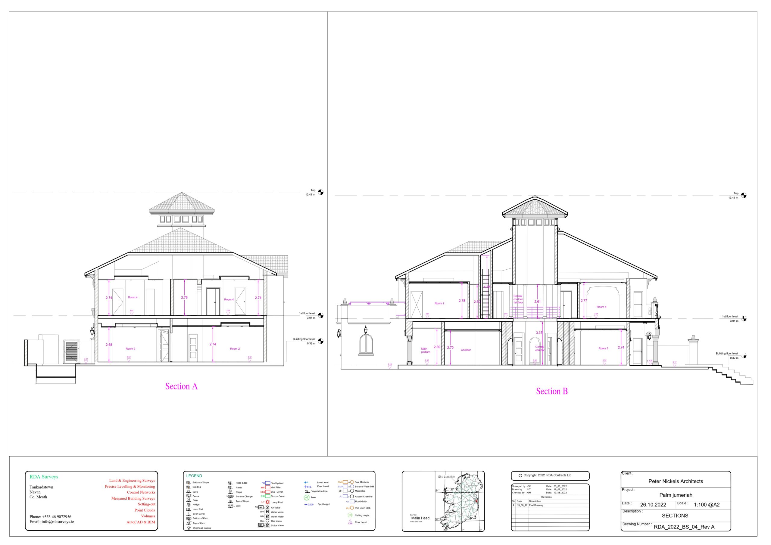
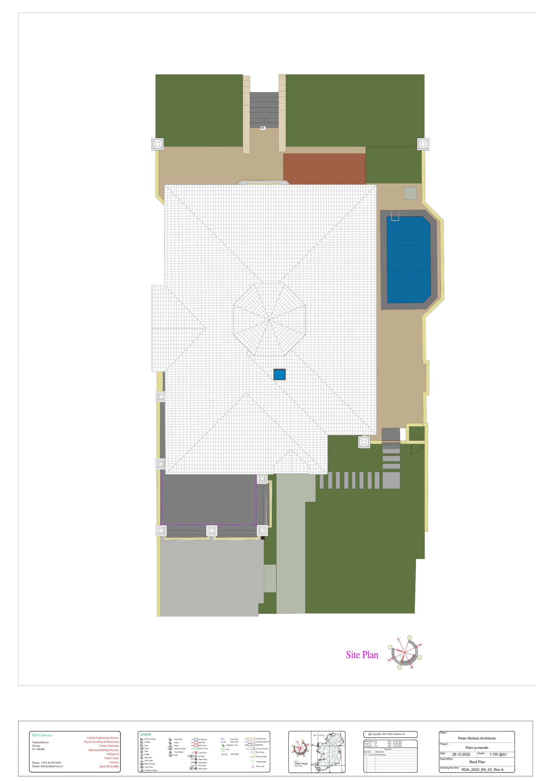
3D Laser Scanning in Dubai, Palm Jumeirah: Our client, a leading Dubai Property Developer, plans a complete remodel of this property.

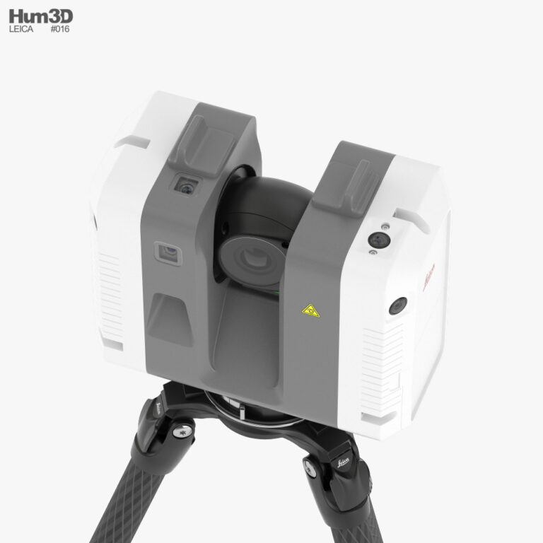
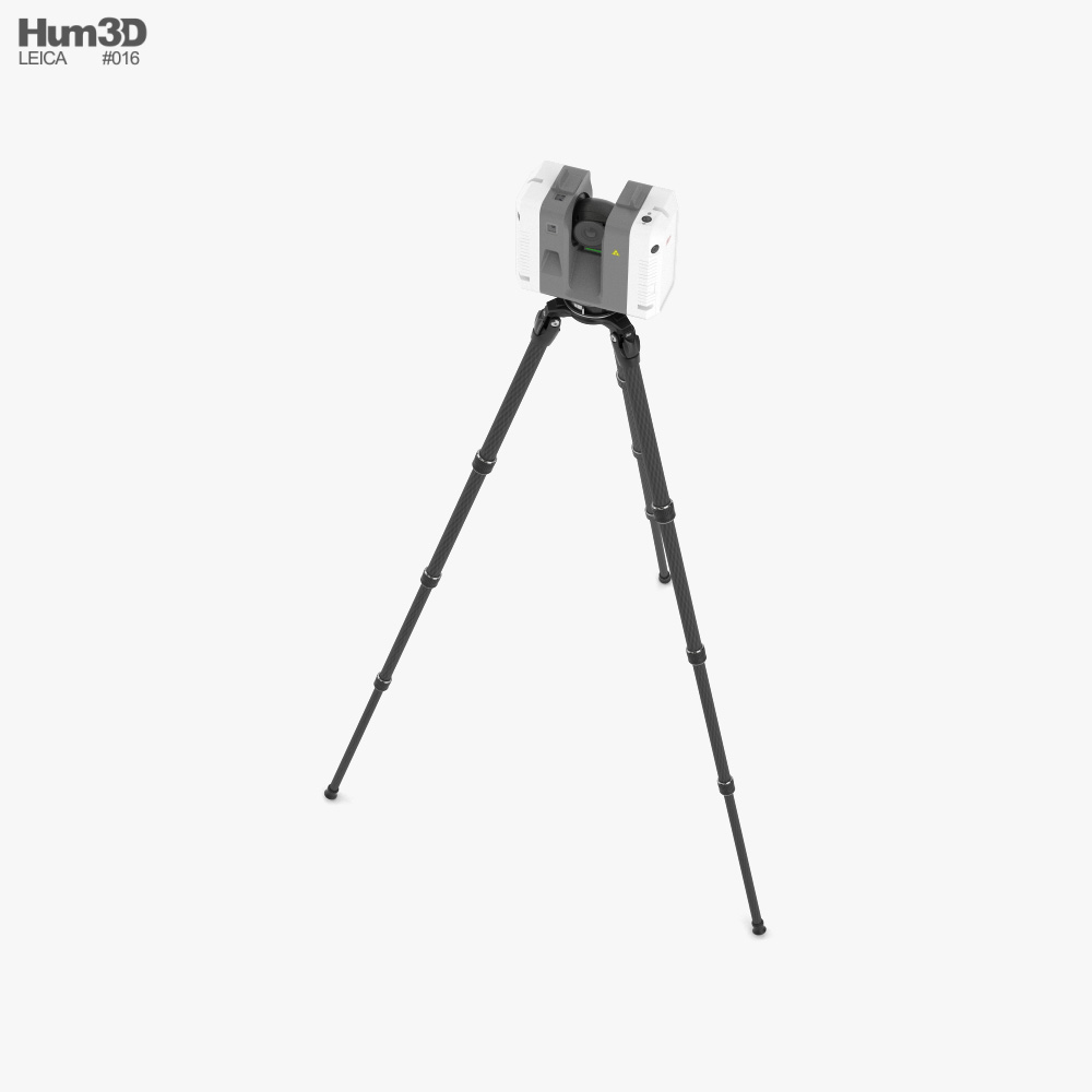
Bimflo data collection process takes only a few hours on site, the equipment is compact and clean, and we require only easy access to the property.

Deliverables

Our client required the following deliverables
  • Registered point cloud file saved as a. RCP file
  • LGS File to be used in True View Enterprise
  • 3D Revit Model of the Project
  • CAD model will serve as the basis from which to design all         new changes and additions.

These are the following points taken into account while preparing the CAD drawings and 3D Model:
  • CAD drawings of floor plans and roof plan
     o Concrete steps at exterior doorways
     o Wall bathtubs, shower units, toilets, sinks,
     o Floor levels, ceiling heights, internal floor area of each                room, show area of full building, dimensions of each                    room, room number
     o Roof plan to also show locations of All rainwater gutter              drains, chimney wall
• CAD drawings of external elevations
     o Elevations of window and door frames to visually match              real-time as closely as possible
     o All horizontal and vertical rainwater gutters and pipes
     o Location of external pipes and cables on building
     o Concrete steps at doorways
     o External lighting posts
• 2no: Sections of the building
     o Sections to show above ceiling profile as best possible

 
added value

3D laser scanning and digital twin introduction provided the facility data that was clearly unattainable in the past. The accuracy of the room square foot measurements is notably essential, and laser scanning offers actual accuracy and can calculate the location of ordinary-formed rooms which is very hard the use of guide methods. The ability to truly visit the site and notice what turned into in the room on the time of scanning is also distinctly precious. The photographs alone are good, but now users can also take measurements and depart facts in places in which it is able to be discovered later inside the digital twin. Accuracy, pace, and human hard work savings are only a few of the advantages this exceptional generation offers centers managers

scanner we used

Our most recent acquisitions, and currently our favored multi-tasking 3D Scanners, are our Leica RTC360’s. Arrival 3D now have several Leica RTC-360’s positioned strategically around the United States. We use the RTC360’s frequently due to their great versatility; portable size, long range accuracy and rapid scanning capability.
   • Speed: <2 mins for complete full dome scan and spherical          HDR image at 6mm @ 10 m resolution.
   • Accuracy: 3D Point Accuracy 1.9 mm @ 10m, 2.9 mm @              20m, 5.3 mm @ 40 m.
   • Range: Min. 0.5 – up to 130 m
   • Highly Portable: Compact & weighing in at 5.5kg (11.7lbs),          the Leica RTC360 scanner’s portable design and                          collapsible tripod mean we can reach our clients quickly              and efficiently.
   • In Use: Once on site, an easy-to-use interface enables                rapid set up per 3D Scan requirements. We can scan in low        thru high Resolution, Color or Greyscale and can                          enable Tilt control.
   • Real Time Registration: Automatic point cloud alignment            based on real time tracking of scanner movement between        setups based on Visual Inertial System (VIS).
   • Final Registration: For the RTC360 Arrival 3D utilize Leica          Cyclone REGISTER 360 software to integrate 3D point                clouds. Output files can be created in multiple formats for          seamless integration into software products such as                    Autodesk Revit, Dassault SolidWorks and many others.

Overview

Walkthrough of Model